Tuesday 24 August 2010

Long Island Slalom

Stepping Stones
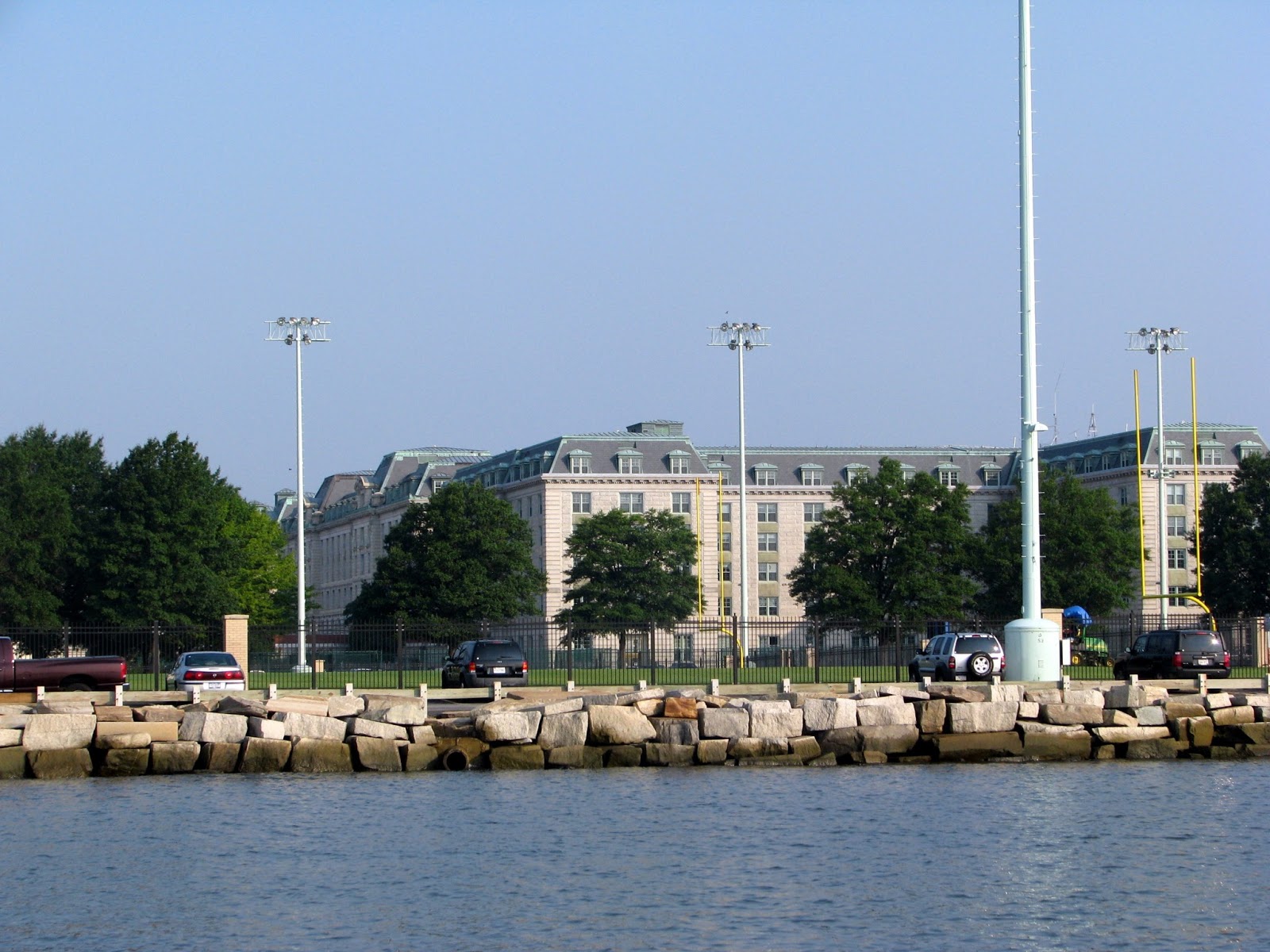
Long Island Sound is fringed by glamorous mansions and lush greenery.  Its waters are awash with impressive motor boats and snappy launches. Smart sailboats with impeccable white sails lean into a perfect breeze, crisscrossing our path.  Artistic lighthouses dot the landscape.  Ah, only in America….  We hurried on (under motor) to our first destination, sidestepping the inevitable crab pots, to Oyster Bay.
Long Island Mansion
The Motleys had decided to hoof it up to Maine leaving time (hopefully) to explore on the way back.  Long Island had simply become another encampment on our journey “down east”.  That is until we left Port Jefferson.  The day was overcast, the wind was up and the Cap’n unfurled WJ3’s sails.  We belted along as the seas grew and breezes “freshened” – not exactly in accordance with the weather forecast…  Pot watch was made all the more interesting, especially as small multicoloured buoys began to appear in deeper, more remote waters.  The skies opened up too and even our Cap’n No Pain quickly put on his wet weather gear.  GS found a fleece jacket too.  Yes!  Cold, wet weather at last...
Nice little Grotto.  A useful idea for Penawar?
We rounded Plum Gut, another torrent of currents, stiff short seas and swirling eddies, in strong gusts of 25 to 30 kts, sails taut and reefed, then surfed the last few miles into Greenport, an old whaling port, situated in Long Island’s fishtail. 
Ferry into Port Jefferson
Greenport’s well protected Stirling Harbor, has town moorings and we were lucky to get one with such foul weather building quickly.  We really did batten down our hatches, crossed fingers that moorings would hold their dancing charges, and guessed our stay would probably be a few days, certainly until the weather cleared.

(Just on a technical note, we have installed Skymate, a satellite communications system that allows us to download weather and a limited number of emails - even out on the high seas.  I hope to be able to connect this to our blog tracker so that even when we are unable to get internet, our most current position/anchorage will be evident.  At least there would be a narrower search corridor if we ever get lost.  There, I knew you cared!)


From: Oyster Bay, LI  Lat/Long: 40 52N  73 30W  Date/Time: 21/8/10: 1115
To: Greenport, LI  Lat/Long: 40 57N  73 05W  Date/Time: 22/8/10: 1645
Time Taken: 83nm (16hrs)  Distance (this year): 517nm (101hrs)
Distance Total (since 2008): 4157nm  (800hrs)   Fastest Speed: 7kts**
Weather: Winds SE 5-10kts; Seas 1ft; TSM’s reported. Actual weather E winds 15-20kts gusts to 30kts; rain, rain and more rain
(** Sailing – doing 6 - 7 kts; well reefed down.)

Monday 23 August 2010

True 'n Sea

Hey der Wocky....
Never make plans to leave on a day that you decide to re-provision, check your internet (at Starbucks 3 miles down the road), re-fuel and re-water.  We finally had our chores all done by quarter to five…pm.  So, what then?  Richmond County Yacht Club had kindly let us fill our very empty water tanks, so we took one of their (nearby) moorings for the night, hailed the launch service to the club and had the best shower we’d had for a long time!!  We also had a beer at the RCYC bar (the evening was really beginning to really look up!) and then decided to cross the road to meet Judy at her Marina Grand restaurant.  This neighbourhood has a distinctly Italian feel (imagine talking to “Rocky**”).  So, our choice of chicken parmigiana and calamari & conch linguine was just perfect.  And it tasted “buono” too!
Now what could that be up ahead.  Yahooooooo!
After our truancy, WJ3 got us up nice and early to take on the East River and the notorious Hell Gate.  We checked our timings and slid up under the Verrazano Narrows Bridge jostling speeding ferries (yes more) and a few massive container ships to hug the east coast (Brooklyn) and sneak into the East River behind Governors Island.  We needed to be near The Battery (Manhattan Island) an hour after low tide.  Such precise timings…oh, yes indeedie!  We needed to catch Hell Gate at slack water…  Hell Gate, a tiny junction of East and Harlem Rivers, can carry currents up to 5kts creating whirlpools and crosscurrents; short standing waves can add to the drama.  A British frigate, the Hussar was trapped and sank in Hell Gate many years ago (1780).  She was carrying gold, pay for the British Army.  That thar gold is rumoured to still be in those murky 100 foot depths….  (Fancy a day in Atlantic City anyone?)
Time for a quick cuppa with Al?
The day was nice, the weather was nice, but all hearts & minds were glued to Manhattan.  The Cap’n steered us past Madam Liberty, brought us close to towering Empire State & Chrysler Buildings and cleared WJ3’s mast under Brooklyn Bridge (1883); all the while dodging ferries, tugs towing huge barges and all manner of recreational craft. 

Further down, we admired the UN Building and tried to call Al for a cuppa as we floated past his NY “shack” and on to Hell Gate.  Nearby Riker’s Island is a prison – talk about location, location, location!  Finally, we had Throg’s Neck Bridge in our sights - our gateway to Long Island Sound.  The water still had a murky tobacco glow to it but we’d made it in, out, and back into open waters (more or less) again.

** You haven’t forgotten Sylvester Stallone have you??
Who's a happy GS then?

From: Great Kills, NY  Lat/Long: 40 32N  74 07W  Date/Time: 20/8/10: 1000
To: Oyster Bay, LI  Lat/Long: 40 52N  73 30W  Date/Time: 20/8/10: 1800
Time Taken: 50nm (8hrs)  Distance (this year): 434nm (85hrs)
Distance Total (since 2008): 4074nm  (784hrs)   Fastest Speed: 6kts**
Weather: Winds kts; Seas ft; Swell; The official weather report said a “nice” day and so it was..
(** Motoring & sailing avg 5kts; 6 kts through East River’s Hell Gate)

Sunday 22 August 2010

Great Kills

Staten Island: Great Kills Harbor

Sunset over Staten Island
We bid goodbye to our sandy little anchorage.  We’d miss being surrounded by a daily flotilla of drifting fishing boats, swooped on by the biggest seagulls you’ve ever seen and rocked by surging ferries (not!!!).  We needed time to prep for open ocean voyaging, get our SkyMate (satellite coms & weather) up and running and re-provision.  We motored the few miles over to Staten Island and into harbour refuge, Great Kills.  Kills is a Dutch word meaning “river”.  The area was once a small fishing & oystering port – no more… 
Snug as a bug...
The harbor was chock-full of mooring balls and marinas wanting exorbitant dinghy dock fees but it was sheltered.  We anchored close to the boat ramp and had instant access (via a bike path) out to a busy main road and shops.  Somehow the area is reminiscent of Sydney’s (well lived in) inner-west.  Amazing how in a few days we’ve jumped from “Gone with the Wind” to Woody Allen’s ”Broadway Danny Rose”. 

The seagull (above) looks smaller than he really was.  The mooring ball is industrial size - a perfect vantage point for a seagull to hold a conversation/issue orders to others. Nearby boats were covered in all manner of handcrafted devices to keep these huge monsters from doing their worst on idle decks.  You could be scrubbing for months otherwise!  

From: Sandy Hook, NJ  Lat/Long: 40 27N  74 00W  Date/Time: 14/8/10: 1510
To: Great Kills, NY  Lat/Long: 40 32N  74 07W  Date/Time: 14/8/10: 1650
Time Taken: 8nm (2hrs)  Distance (this year): 384nm (77hrs)
Distance Total (since 2008): 4024nm  (776hrs)   Fastest Speed: See Note**
Weather: Winds kts; Seas ft; Swell
(** It was a nice afternoon and we motored because we could!! Avg 4kts)

Saturday 21 August 2010

Poetry in Motion

Sandy Hook Bay: 12 Aug 2010

Meet R2D2
We had a great ride overnight but that east wind was not going to let us have an easy entrance into New York Bay.  We surfed in on rather too large waves, holding as steady as we could up a narrow channel, Cap’n working the sails like a man possessed.  But we did it.  Under sail.  No engine.  No need for coffee, cake or other stimulants, we’d made it.  We were safe and snug in our new anchorage.  Bold sailors are we!

The Coast Guard must have been getting sick of us though.  It did take 2 days for Cap’n Remarkable to work out what was preventing WJ3’s engine from working.  Yes, we knew the ongoing issue was dirty fuel; and under guidance from the friendly crew at Marina on the Bay, a not so short dinghy ride up the Shrewsbury River, the problem was solved.  Gunk had blocked up not only the filters (which the Cap’n was checking daily anyway & ultimately changed) but also the fuel line tap (at the tank).  Scott had taken the Cap’n in hand, provided professional advice, driven him to West Marine for spares and had mechanics, Chris & Rob working on the case – all on a Friday afternoon!  Brilliant!  The problem was solved and WJ3’s engine chugged happily again.  The Cap’n has earned himself an Advanced Diploma in Diesel Engine Maintenance (on the High Seas).  We are forever grateful to Scott and the lads!

Thursday 19 August 2010

Perilous Pauline, Oh Oh!

Cape May to New York Bay

By the time an early morning mist had lifted off our safe little anchorage, Cap’n & First Mate had decided to forgo the delights of historical Cape May and move on to Atlantic City, a short 38nm run on a windless ocean.  This was home to one Trump Casino and nearby marina (yes, that Trump!) and its glitter lured (one of us) like the famed Emerald City.  Just how glittering we were soon to realise!
I knew they'd come in handy one day!
The Cap’n and his sea-gods were in perfect alignment about an hour off Atlantic City.  WJ3’s engine failed and despite all efforts (at least 4 hours hove-to) we were unable to start it.  What now?  After surviving a rough & tumble ride through Cape May’s narrow, rocky inlet, GS had visions of WJ3 being pinned to sea walls as the Motleys tried under sail to make headway into Atlantic City’s inlet.  What then, even if we did make it?  Where would we anchor? 
New davits hard at work
New York Bay, 80nm to the north, was wide and if we had a fair breeze, we could tuck in behind Sandy Hook by the next day.  So, somewhat unprepared but unfazed by an overnight adventure, the Cap’n handed round safety harnesses, put out lots of sail to catch a steadily increasing evening breeze and slowly sailed off into the sunset.  As if to taunt us, it took ages to pass by those bright neon lights of Atlantic City (largely due to GS steering south until noticed by the Cap’n – damn it, she was going to get to Trump Marina somehow!) 
 
From: Cape May NJ  Lat/Long: 38 58N  76 28W  Date/Time: 11/8/10: 1045
To: Sandy Hook, NJ  Lat/Long: 40 27N  74 00W Date/Time: 12/8/10: 1720
Time Taken: 115nm (31hrs)  Distance (this year): 376nm (75hrs)
Distance Total (since 2008): 4016nm  (774hrs)   Fastest Speed: See Note**
Weather: Winds E 5-10kts; Seas 1-3ft; inc in evening; overcast next am & blustery
(** Mostly sailing as engine conked out of Atlantic City; avg 3-4kts)

Wednesday 18 August 2010

Sea Nettle Bay

Annapolis to Cape May (via Chesapeake & Delaware Canal)
Naval Academy, Annapolis
After Solomons, WJ3 dropped the hook in very unsettled waters, right in front of an impressive Annapolis Naval College.  Yes, we were up for reveille early next morning, did callisthenics (a whole hour & a half – never my best subject) and finally took a short break for breakfast (at 8am!) before engaging in noisy, rough-house gridiron on the out-field.  It was exhausting just watching it from our bouncy deck.
A little more sport - racing on the harbour
We had arrived at Annapolis on a Sunday, the day everyone is out posing on their boats, boat watching others or just messing about (to be seen of course, darlinks!).  The Motleys watched the world go by - mini-cruise liners with wine/cocktail sipping lounge lizards; large pointy boats with throbbing engines and oh so hip owners; fabulous 100’ schooners packed to the brim with day trippers;  annoying jet skis & their acrobatic owners and dinghies of every conceivable shape or size, many stocked to the hilt with kids & dogs or if luckier, bow bunnies in skimpy bathers.  No wonder the boat show is held in Annapolis – it’s just part of a permanent exhibition!
Still Pond Sunset
After the high-life we moved on further up-river to the lovely and aptly named, Still Pond.  Amazingly, we seemed to have seen the last of those horrid sea nettles, stinging jellyfish that just lap up the warmer Bay waters.  We had our first swim of the season in brackish water – but it was refreshing!  From here, the First Mate plotted our attack on the C&D Canal, said to be a challenge due to its size (small) and size of vessels (large) travelling on it.  The Canal, although planned as early as 1661, was completed in 1829.  It had 4 locks and six mule teams to pull towboats through it.  Not so today, it’s a busy bypass with a snappy current.  Look forward to that!
Traffic and Obstacles on the C&D Canal
As the Motleys needed the tide with them, we were up at the crack of dawn and well into the Canal before morno’s.  Luckily, we had it to ourselves and the tide pulled us steadily along – we were actually travelling at an unheard of 9 knots!  At least it was in the right direction.  We spat out onto a mirror-like Delaware Bay, the subject of many a nautical horror story. So, making the most of our good fortune, the Cap’n steered us (yep, still no wind but we held a fast, outgoing tide) down the bay, over some interesting shoals with weird names like prissy wicks, negotiated around a very large, very close ferry, felt the swell of Atlantic waters and on into Cape May. 
Delaware Monsters
Space to anchor was a premium in Cape May, so we resorted to asking advice from a very nice water-policeman.  We finally settled in front of the Coast Guard Station, just off the New Jersey ICW, and dropped anchor right on dusk.  The Motleys had broken out of secure bay waters (sort of) and were now trying to recall what this overnight sailing thing was all about…..

From: Solomons Island, MD  Lat/Long: 38 20N  76 27W  Date/Time: 8/8/10: 0910
To: Cape May, NJ  Lat/Long: 38 58N  76 28W Date/Time: 10/8/10: 2020
Time Taken: 188nm (29hrs)  Distance (this year): 261nm (44hrs)
Distance Total (since 2008): 3901nm  (743hrs)   Fastest Speed: 9.1**
Weather: Winds E 5kts; Seas 1ft; mill pond conditions – jellyfish moved faster
(** In the C&D Canal.  Otherwise mostly motoring with a little sail at times; avg 5-6kts best with tide)

Monday 16 August 2010

Water Torture

Solomons Island:  5 Aug 10

Chesapeake Lighthouse
Our first obstacle on entering the Patuxent River was to avoid going anywhere near a huge Navy Base on the southern shore.  It, of course, came to us.  Booming jets practicing landing drills roared overhead, using us as pretend target practice.  We could almost see the smiles on the pilot’s faces as we ducked and tried to move just a little faster. 
Idyllic Anchorage
Our next challenge was a sudden thunderstorm creating great gusts (35mph) trying to flatten WJ3 out.  Fortunately we had no sail up as WJ3 had been having a few engine “issues” (dirty fuel).  GS was sent forward in this storm to set up the anchor in case “we” suddenly had no forward propulsion.  Gee, thanks…
Early morning on Back Creek
Eventually, but not soon enough, the Motleys made it in to safe harbour, passing by Tow Boat US escorting a hot water boat that had earlier sent out a Mayday call.  We tried not to stare judgementally, but what the hey, everyone else at a nearby marina was gawking, so why not?  Finally at the end of Back Creek we dropped the hook.  “No good,” said Cap’n Ready for Action, “there’s only 4 ½ feet of water here".  What?  We draw 5 ½ ‘ – how did that happen?  GS was sent forward again as lightning flashed and the heavens opened up (our Cap’n was safe and dry under the bimini) to haul up the anchor and then reposition it in deeper water.  Gee, thanks…..

So here we sit just outside the Holiday Inn in an idyllic little creek waiting for northerlies to give way to more friendly southerlies.  We’re taking photos to send to Hornsby Council.  We think the Hawkesbury waterways should look like this, ducks and geese included…..

From: Reedville, MD  Lat/Long: 37 50N  76 16W  Date/Time: 5/8/10: 0800
To: Solomons Island, MD  Lat/Long: 38 20N  76 27W Date/Time: 5/8/10: 1750
Time Taken: 47nm (10hrs)  Distance (this year): 73nm (15hrs)
Distance Total (since 2008): 3713nm  (714hrs)   Fastest Speed: See Note**
Weather: Winds SW-W  5-10kts; Seas 1-2ft; overcast
(** Mostly motoring with a little sail at times; avg 5-6kts)

Sunday 15 August 2010

Take the Spider to the Nun

Reedville: 4 Aug 10
Some people have ordinary gazebos, others don't.....
The entrance to Great Wicomico River is guarded by a 42’ “red spider” surrounded by shallow water and thickets of oyster stakes.  Welcome to the oyster shores  and deep water of our first overnight anchorage, Cockrell Creek.  Before you have visions of lovely fat juicy oysters, Reedville, now a quiet fishing hamlet, is home to the only (and remaining) menhaden processing plant – a vast steaming and smelly cauldron; worthy of a supporting role in any of Shakespeare’s plays.
Back at the Plant, things were a little quiet
Menhaden are also called alewives, bunkers or pogies.  Any the wiser?  Will “little oily fish” do then?  Reedville was founded in 1873 by Elijah Wood who recognised the potential of these little fishies and set up what was to become a huge and profitable industry.  The town itself is festooned with Victorian mansions set between fisherman’s cottages, from those prosperous days. 
Purse boats on either side of mother 
Meanwhile, back at the plant, huge, industrial-gray mother ships line sparse docks, peeping out behind a backdrop of steam, smoke and smell.  Spotter planes are used to make a fix on schools of menhaden.  The mother ship, bearing 2 small purse boats, moves to the identified location.  These purse boats then encircle the school (called purse-seining) and bring it in for ummm, “cooking”.  
Heading home with the days catch
Yes, they were “cooking” when we arrived and despite choosing a secluded anchorage upwind of the factory, it became downwind right on dinner-time.  There is nothing more enhancing to the gentle waft of cooking pizza than breathing in gasps of piquant air akin to rotting hops and out-of-date whiskers (cat food).  Yum, hand me another pizza slice, please.


From: Deltaville, VA  Lat/Long: 37 32N  76 19W  Date/Time: 4/8/10: 1300
To: Reedville, MD  Lat/Long: 37 50N  76 16W Date/Time: 4/8/10: 1800
Time Taken: 26nm (5hrs)  Distance (this year): 26nm (5hrs)
Distance Total (since 2008): 3666nm  (704hrs)   Fastest Speed: 6kts**
Weather: Winds S  5-10kts; Seas 1-2ft;
(** Mostly motoring with a little sail at times; avg 5-6kts)

Friday 13 August 2010

Moving to the Start Line....

Jackson Creek 30 July 10 (noon)
Puppy Love (Rosie)
Not wishing to overstay in Deltaville (11 weeks now was it??) we packed and positioned ourselves on “the start line”.  Decorated with new solar panels, a newly serviced engine and various other absolutely necessary commodities, WJ3 dropped anchor and some very, very rusty chain in muddy Jackson Creek. 
On anchor at last!
After some social days starting with dinner on board with Greg & Bev, who also have a Hunter 460 & are Aussies too, we were kindly invited to neighbour’s cocktails by Bill and Mary in their Jackson Creek boathouse.  The GS was kindly invited to the Sting Ray Quilters monthly meeting.  The odd bit of prep work was worked in around our social mores and then finally we set about throwing away our dock lines.  Only WJ3 caught us napping and threw a solenoid spanner in the works.  The solenoid belonged to the gas bottle and that meant, horror of all horrors, NO COFFEE….
A Working Deadrise
So we delayed for yet another day.  Meanwhile Hurricane Colin was threatening and predicted to head our way.  Life is never simple. 

(Editorial note:  We are sitting in Starbucks, Staten Island (yes - so close to NYC!) and it's the only internet we've had in a little while.  So you are getting posts now with photos to follow later when we have the luxury of wifi on an anchorage somewhere - anywhere!  Meanwhile I feel like I'm on the set of a Woody Allen movie.)

Tuesday 10 August 2010

A Royal Invitation

 Governor's Palace - A Guided Tour: 19 July 10
By now you are probably fed up with our historical posts, but we’ll finish on a high with the Governor’s Palace (and a few bits of Colonial Williamsburg fabric too).  We had walked to the Palace via the old plantation to be on the first tour of the day.  We were lucky to be let in, so the parlour maid told us, as everyone was busy preparing for a ball that evening.  But as we were special guests, she would show us around so that we would know what to do when arriving for the ball later that evening. 
Fancy Ballroom with very vivid Carpet
First however, lessons in a proper curtsey – just in case his Lordship happened upon us while we were in the house.  Apparently the house had been recently renovated by the new curator for Colonial Williamsburg.  He had asked that the Palace be more in keeping with the era.  Some approved, others did not!  Either way, it was absolutely stunning and the ballroom most impressive.
Her Ladyship's Bed Chamber

And Stately Grounds
The grounds were equally as inspiring.  We missed getting back to the kitchen where cooks were busy preparing for the evening’s feast or perhaps seeing musicians rehearsing for dancing.  We had to tear ourselves away, wishing just one or two hours more, to return our hire car on time and get back to the daily grind.  Just enough time to dash off and buy a few more fat 1/4’s. 
His Lordship's Collection
Meanwhile back at the Yard, the Opti kids had not destroyed too much of the marina and opti-mism was (up more or less) as was the temperature & humidity – still high 90’s to low 100’s.  Somehow we couldn’t even get up the enthusiasm to go to the Maritime Museum’s monthly music fest – Jumbo Lump Daddy and the Backfin Boys (I kid you not) were the feature act. Damn, now how lazy is that!   

Monday 9 August 2010

Folk & Decorative Art

Colonial Williamsburg: 18 July 10
Oh yes, that is my town carriage
America is famous for its decorative and folk arts.  It is interesting to realise that years of isolation (more or less) from European influences led them to creative and local problem solving.  In a maritime sense, rather like the specialist log boats built for Chesapeake Bay fishing (see Deltaville Maritime Museum).
Basket Makers 
After our historical baptism, we took in more mundane domestic activities stopping at the Carpenter’s workshop (took me a while to get Cap’n Cabinetmaker outa there) and a brick factory sidestepping an invitation to work clay with our feet.  That’s where I lost him!  He went on to visit a gunsmith & foundry and then to the blacksmith whilst I took in the weavers and milliners.
This handsome chap also plays records
We did take an afternoon tour (yes, both of us – GS insisted) of The DeWitt Wallace Museum’s decorative highlights – this tour focusing on furnishings and clocks, then following that to see whimsical pieces in the adjoining Abby Aldrich Rockefeller Folk Art Museum.  It is always more interesting when you know that something special about each piece.  The entrance to these collections is via the old hospital, one of the first for the mentally ill.  Sure glad we have different medical practices these days!
A rather nice teapot
While the Cap’n went elsewhere to play, GS wandered through collections of business signs and windvanes, admired a glittering carousel and found at last a small room of quilts.  Not all was lost however as a special exhibit of quilted clothing (mostly wholecloth petticoats) tempted serious quilters.  This time I had to get out my glasses to see those tiny stitches…oh, my!


Kings Arms - a dining experience
Our evening meal at the Kings Arms Tavern of game pie and Mrs Voles house chicken was complemented with a special selection of colonial “sides” like pickled corn, salt-cured ham, watermelon rind pickle and creamed spinach.  Musicians entertained us on elaborate spanish guitars and unusual mandolins (flat bottomed for easy transport). But, NO time for dessert, we had a TV in our room (after 2½ months, yahooie!) - Inspector Poirot was on.  The Captain was especially critical.