Showing posts with label bvi. Show all posts

Thursday, 24 July 2008

Throw out the GPS & get a pig

Across Neptune’s Hell: 10-11 Jul 08
Anegada Passage
Our advice had been to wait for calm seas and light winds, then motor…. The Anegada Passage was to be a challenging sail. Some relief unexpectedly came in the form of Big Bertha, a named cyclone twirling about in the Atlantic to our north…. Now what was that I just said?

With a forecast promising “reasonable winds” the Motleys set off from Anegada late afternoon for an overnight sail directly into seas “that can get quite rough in fresh trade winds”. Needless to say, it didn’t take too long before a bucket came out.

The boys rallied as GS clutched her bucket below and we made a reasonable fist of it under sail, despite getting a little sideswiped by a strong current. This meant we did have to motor for a little while to get back on course and added extra hours to our journey of 20 hours 20 minutes (it seemed sooo much longer!). Obviously I’m still alive; it must have been the scent of fresh baguettes wafting from across Marigot Bay that roused GS.
Galley Slave hard at work
This brings to mind a story we read about a local Caribbean navigation technique involving a very long line and a very hungry pig (both items which must be on board of course!). Traders from St Vincent sailing to Barbados would throw this pig overboard (only when they thought they were close, silly), and spurred on by the smell of sweet molasses, the pig would swim toward the island. The rope ensured the boat followed piggy. Clearly this method was used in a time before the movie Jaws. I wonder did they carry “back-up” pigs on board?

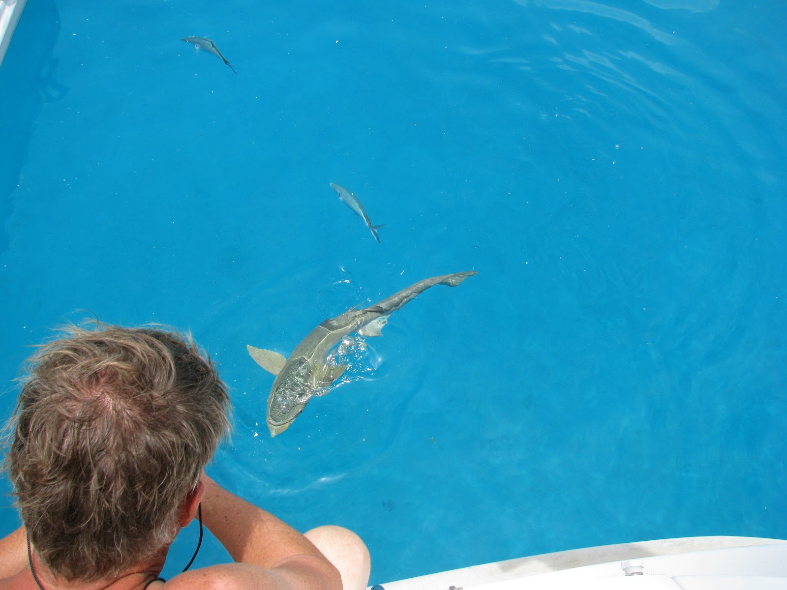
We trailed a lure expecting something decent to attach itself – especially given such quality of burley… All we managed was some hapless seagull who saw a hearty dinner in our lurid pink plastic squid. The Cap’n managed to unhook him and provide first aid. He’d swallowed rather a lot of sea water as you would expect. Happily, he now has something of an adventure to tell his grandchildren. 


From:  Anegada, BVI             Lat/Long:18 44N  64 23W Date/Time: 10/7/08: 1200
To:  Marigot Bay, St Martin  Lat/Long:18 04N  63 05W Date/Time: 11/7/08: 1100
Time Taken: 115nm (20.5hrs) Distance (this year): 192nm (44hrs)
Distance Total (since 2008): 192nm (44hrs)   Fastest Speed:
Weather: Fresh Trade Winds ENE 12-15kts; 4-5 ft swell; 0.5kt W current

Wednesday, 23 July 2008

Lobster Island

Anegada Island: 9-10 Jul 08
Anegada at Dusk
I should mention that our brave Cap’n, having sailed in to North Sound through a very narrow channel between reefs off Mosquito and Prickly Pear Islands, also sailed out! We arrived at Anegada quite early as it seems our invitation to stay at Necker Island (owned by Richard Branson) had gone astray. Apparently it’s the most exclusive resort in the world….with its own 300 year old Hindu meditation hut. Ho hum. Didn’t somebody tell him they’re on every street corner in Delhi?
Pelicans near Setting Point
Anegada means “place of drowning” and it seems appropriate given the number of wrecks on its extensive reefs. The island is coral (not volcanic) so it is extremely flat (and hot!) but home to the largest lobsters I’ve ever seen in my life. Given that it’s generally off limits to most charter fleets, we hoped for a peaceful anchorage. Oh, what a mistake! A rally group of about 40 yachts had arrived and settled in before us. Worse still, they had dibs on the daily lobster catch!
Boy Scouts at Whispering Pines, Anegada
We found a mooring away from the crowd but with less than 2 feet under the keel; on tender hooks was our Cap’n! One of the nice features of WJ3 is that it is so easy to swim off the back. With the addition of a boarding ladder and hot/cold outdoor shower, we are in complete luxury! 

Later we took a quick walk around Setting Point (it really is quite a remote island) and settled in for sundowners at Potters by the Sea and then Whispering Pines – a bit of a bar crawl round the anchorage. This gave us false courage to anticipate our next big adventure – crossing the notorious Anegada Passage.


From: Biras Creek, North Sound Lat/Long: 18 30N  64 22W Date/Time: 9/7/08: 1130
To: Setting Point, Anegada BVI   Lat/Long: 18 44N  64 23W Date/Time: 9/7/08: 1430
Time Taken: 14nm (3hrs) (See Note 4)  Distance (this year): 77nm (23.5hrs)
Distance Total (since 2008): 77nm (23.5hrs)   Fastest Speed:
Weather: Fresh Trade Winds 12-15kts ; 4-5 ft swell
 (Note 4: Apologies for the repetitious information in this table – our blog is also serving as our online cruising log.)

Tuesday, 22 July 2008

The Bitter End

Bitter End: 7-9 Jul 08
Last Stop Bar, Gun Point
A pleasant 4 hour sail saw us arrive at North Sound, Virgin Gorda. It’s rather like a big lake ringed by coral reefs and windswept hills – we stayed 2 nights and cleared (customs & immigration) out of Spanish Town – although that trip back across the island was by taxi. After being driven by Gafford in his big red truck, the boys decided that a beer at the Last Stop bar at Gun Point was necessary. The locals said not to complain about the roads because they didn’t have any until 1960…. Again, narrow hill huggers that left us breathless but the views down onto the Sound were spectacular. Did I stop to take a photo from the top…no way!!!
Hollywood in Biras Creek
We had moored off Biras Creek, an exclusive water access only resort – a bit like Dangar really (just kidding) in a well protected, very quiet spot. We happened upon another turtle going about his daily life chores until Hollywood splashed down. 

Further round are the larger resorts of Bitter End Yacht Club and Saba Rock. We had sundowners at Bitter End and dined over at Saba Rock, which true to its name is indeed a rock – well a resort on a rock, umm, a very small rock. We ate dinner watching large fish circling us as if we were the ones on show.

(And no Mum, we still can’t eat the fish!).
The Bitter End
Apparently if you are a sailor, you’d know that bitter end is the free end of a line – the last bit. North Sound is the jumping off point for Atlantic crossings to England or in our case (thankfully) a much shorter passage over to the Leeward Islands, starting with St Martin. We decided that we could gain some advantage by setting off from Anegada, further north and waiting there for a better weather window: I’m still getting used to all this “nautical” stuff. Oh, and I found out that pusser is purser..(I only know that because it’s also a rum!) I always used to wonder about the unkind names those navy types used at NWCC!


From:  Baths, Virgin Gourda    Lat/Long: 18 26N  64 27W  Date/Time: 7/7/08: 1200
To: Biras Creek, North Sound   Lat/Long: 18 30N  64 22W  Date/Time: 7/7/08: 1630
Time Taken: 14nm (4hrs) Distance (this year): 63nm (20.5hrs)
Distance Total (since 2008): 63nm (20.5hrs)  Weather: Fresh Trade Winds 12-15kts
Fastest Speed:
(Note 3: Well, now I’m threatening to get out my calculator!)

Friday, 18 July 2008

Doing the Virgins

Sunny Caribbee: 5-7 Jul 08
Bruce out for a spin
Bruce’s (our dingly – sorry Bruce – it’s such an Ocker name) outboard was playing up, so we had to order a new black box. “I’ll check out back,” the man said. Then later, “I'll have to order one in”. We decided to wait away from the swelter of A Dock and explore more of the BVI’s famous anchorages. First stop – Cane Garden Bay; but by sea rather than road roller coaster…  

The trip was effortless. We admired Soper’s Hole (yet another pirate lair) and by-passed Teach Island (named after Blackbeard) before rounding West End and into a sudden rain squall. It was the most rain we’d seen for weeks. Water is generally sourced by desalination (& is quite expensive!!), so we tossed up whether to get out our wet weather gear or a cake of soap!

Cane Gardens was relatively quiet, but Hollywood’s new found friends managed to track him down. It was the last we saw of him for the evening. He managed to bring back a few more friends the next morning….the beach was crowded. Finally the penny dropped – a cruise ship had docked in Road Town! Our idyll was shattered…

Hollywood hard at work
The next day we cruised past the top end islands spotting Windjammer IV at Marina Cay (as you do). Quite a romantic story attached to this small island but now it’s surrounded by concrete resort developments – quite a confronting contradiction. We cruised on to Virgin Gorda (Fat Virgin – and why not?). Our destination was the famous “Baths” but we chose to hang off on a swelly mooring near Spanish Town until better morning light. The Baths is a boulder strewn coastline supposedly perfect for snorkelling. Although a protected marine environment, the charter cats streamed in… Yep, time to move on.

Time to find out about our engine part; Cap’n S rang the mechanic. “I’ll check out back,” he said. Then later, “I'll have to order one in”. Sounded much too familiar so we decided NOT to wait…

From:  Tortola, Nanny Cay Lat/Long: 18 24N  64 38W  Date/Time: 5/7/08: 1200
To: Baths, Virgin Gourda    Lat/Long: 18 26N  64 27W  Date/Time: 7/7/08: 0900
Time Taken: 27nm (5.5hrs)** Distance (this year): 49nm (16.5hrs)
Distance Total (since 2008): 49nm (16.5hrs)  Weather: Fresh Trade Winds 12-15kts
Fastest Speed: (Nanny Cay to Cane Gardens 11nm; Cane Gardens to Virgin Gorda 16nm)
(** Damn that trip meter! And photos to come folks - when I work out how!)

Thursday, 17 July 2008

Even More Testing Times

Second Test Sail: 29-30 Jun 08
Surfer Dan & Caribbean Sea
Now brave from our first endeavours, we decided to stay out overnight somewhere. For safe keeping, Hollywood brought along a culture guide, surfer Dan. Who knew what dangers might befall us? We set the main (a nice little in-mast furler) and the headsail (roller furling), then headed out across Freebooters Gangway (Sir Francis Drake Channel) for Norman Island. 

Norman Island was named after a particularly nasty pirate (or was it a rum, hmmm?). Which one? Well, it seems there’s just so many to choose from! It must have been a pirate because he buried Spanish gold in the Caves, off Treasure Point. We later snorkelled the Caves for sunken treasure but only managed to find an interesting variety of fish and one hungry turtle. We will not mention the Galley Slave's minor tussle with the dingy. Age does not improver grace nor coordination – and once out of the dingy, it is difficult to get back in without a ladder.  Such a performance did rather embarrass the boys…..

Friends at Willy T's
This island is also said to be the one RL Stevenson based his novel “Treasure Island” on. But there’s little sense of isolation anymore! The Bight at its best is a popular forest of masts. It’s also home to “Pirates” and “Willy T’s” both famous for their libations. Willy T’s is a floating bar named after a Quaker plantation owner and doctor from the late 1700’s. Today, painkillers and body shots (don’t even think of asking unless you’re over 25) are expected protocol & poor William is probably turning in his grave at the very thought!!
Hollywood Style
Overnight, The Bight became a wind funnel, so we were happy to move round to Benures Bay the next morning. We had it all to ourselves – everything you can imagine in any Caribbean glossy – for a few hours at least. 

The Cap’n and Dan walked to the top of Spy Glass Hill (once a lookout for pirates) and took some great photos of WJ3….just as she was dragging her anchor. The anchor looks like it could hold an aircraft carrier but between Hollywood & GS, and that wonderful electric winch, they had it all sorted in no time! 

The people in the hot water boat next door looked a bit blanched but you can’t have it all ways, now can you?


From: Tortola, Nanny Cay Lat/Long: 18 24N  64 38W   Date/Time: 29/6/08: after lunch
To: Norman Island  Lat/Long: 18 19N  64 37W Date/Time: 30/6/08: “Sundowners” time
Time Taken: 11nm (3.5hrs) (See Note 1)  Distance (this year): 22nm (6.5hrs)
Distance Total (since 2008): 22nm (6.5hrs)  Weather: Fresh Trade Winds    
Fastest Speed:
(Note 1 – remind oneself to check the distance before turning off the instrument panel!!)

Wednesday, 16 July 2008

Testing Times

First Test Sail: 28 Jun 08
Benures Bay
The Motleys quietly slid out of dock and motored off into Sir Francis Drake Passage. Modern adventurers are we (yo ho ho) but we did leave our cutlasses and blunderbusses at home….

The Virgin Islands were named by Columbus in 1493 in honour of St Ursula and the 11.000 virgins who sacrificed their lives rather than submit to the wayward Huns - as any self respecting virgin would. Mind you, the history of the BVI’s had been somewhat less than “virginal” to date. Columbus was something of a latecomer as the islands were once home to fierce and cannibalistic tribes. But wait, there’s more….pirates! It seems that European nations, eager to challenge Spanish dominance, unofficially supported smuggling, piracy and privateering practices until the early 1700’s. Familiar names like Drake, Blackbeard and Henry Morgan struck fear into the hearts of coastal traders & the Spanish with their loads of Aztec gold and spices. Pristine coves and submerged coral reefs provided perfected lairs and nasty traps for dirty deeds.
Inter-Island Ferry
Hot on the heels of law enforcement agencies whose job it was to clean up the flourishing pirate trade, were plantation owners and imported slaves setting up sugar cane and cotton farms. However, life was extremely harsh on these plantations and conflict was rife; especially after slavery was abolished in England in 1772 and somehow the plantation owners forgot. Little evidence remains though of this fascinating history and in these blue skies and sparkling waters it somehow seems further consigned to the realm of fantasy; thanks so much to modern movies and flash graphics.
Norman Island Lookout
Safe from pirates and in true windjammer style, we hoisted sail and took a course toward Santa Monica Rock, to the south of Norman Island. After sticking our nose into the Caribbean Sea, and feeling the freshness of 20 knot trade winds, we turned round and headed back to Nanny Cay, feeling very pleased with our first efforts under canvas.


From: Tortola, Nanny Cay Lat/Long: 18 24N  64 38W    Date/Time: 28/6/08: after lunch
To: South Norman Island   Lat/Long:   18 19N  64 37W  Date/Time: 28/6/08: afternoon
Time Taken: 11nm (3hrs)  Distance (this year): 11nm (3hrs)
Distance Total (since 2008): 11nm  (3 hrs)  Weather: Fresh Trade Winds    
Fastest Speed:
(Blogger seems to hate tables.  WJ3’s Log format has been changed with the transfer so as not to upset the vagaries of html.)

(Thanks to Bruce on Isa Lei for the idea of this table format. Check out his Round Oz adventures. And forgive me my rusty navigation calculations!) (Ed: Isa Lei's adventures are no longer on the net 2010)

Sunday, 6 July 2008

Rum & Roti

Fine Dining

Cuisine here is a fascinating mix of hamburgers and fries, steaks or curried up rotis – flat breads filled with chicken & potato curry and drenched in mango chutney. All designed of course to sop up any alcoholic over-indulgences. Bars abound and some are more infamous than others – partying any night is de rigueur here. Needless to say, Hollywood’s right into it.
Dinner for who?
True local dishes offer soups and stews – not really appealing to us in this climate. GS went through the checkout last week with a lady buying “hogs feet front, toes on” (even less appealing!) but with lime and hot pepper sauce added, it is the main ingredient in souse.

Fish has hardly featured in our diets so far due to a cunning organism called ciguatera. This toxic critter is eaten happily by reef fish but less so by humans, who tend to die. So fishing is out. A fishing licence is also necessary. Just ask the chap who is now languishing in jail thinking about his US$ 46,000 fine. Ouch!
Cane Gardens Bay from high: a great surfing spot
Rum is the drink de jour, with enough varieties to please even the most ardent connoisseur. Captain S has even been persuaded to give up the G&T's. Yes, we're all in shock! Anyway, I'm sure we'll have more to report as we travel south, sampling local varieties. I have a little stock of oz wine and hope to expand the cache to include some Chilean whites...no casks though, so we feel very indulgent.

For those like us who knew only a little about the Caribbean and even less about the BVI, the following map of the islands and this interesting web site for visitors may help...


Saturday, 5 July 2008

Getting to know all about you..

Two Tortola Doves
Local delights
Whilst the Captain slaved, Hollywood took me on a tour of Tortola Island – to see his favourite surfing spots and bars (hmm, just how much work has he really done??). Tortola, meaning turtledoves in Spanish, is the largest of the BVI’s, and home to its capital, Road Town. The island is volcanic and amazingly steep. We drove slowly up one road nicknamed “the elevator”, hung on grimly to those high ridges before hurtling down the other side into beautiful Cane Gardens Bay.
Are you sure that's a "3"
The Islands support a huge charter fleet; no small flotillas for the god damns, that’s for sure! Cats the size of football fields – anything under 40 foot is small here – rest in marinas, anchor in bays and float off moorings in huge numbers. Recent scuttlebutt tells of a brand new 50' Beneteau, now resting 180 feet below in Davey Jones' locker (& unrecoverable!).

I’ve read that 45% of the BVI’s economy comes from tourism (and probably insurance claims??). I’m not surprised. Little it seems is grown or manufactured here. It’s all imported and meets the demands of those “you know who’s”.

Not another bar..
Tortola seems to have a church on every corner, curiously named bays (Fat Hogs) and restaurants (Struggling Man’s Place); and K Marks, a huge, white building (possibly visible from space?) with a welcoming sign over the door asking its patrons to “Look what the Lord has done”. Indeed…

Friday, 4 July 2008

Dropping the Hook

Sydney to Tortola, BVI: 1 May-27 Jun 08

Anchoring off Benures Bay
This was a plan hatched on a beach in sunny Phuket (Thailand). We fell for its tropical charms and wondered about a retired life abroad….as you do after a great snorkelling trip, a few rounds of the nearby marina on hire bikes and one too many Tigers! So then, just how did the Motleys end up afloat in the middle of the Caribbean?

Meet Windjammer III, a 46ft charmer, all woman and at just the right price for an improved version of our “living overseas and seeing the world from the comfort of our own home” vision. Windjammer is a Hunter 460, purchased in Oct/Nov 07. She is comfortable below, most of the kinks are now ironed out and we are well provisioned to head out on our first BIG adventure: cruising from the British Virgin Islands south to Trinidad via the Leeward and then Windward Islands.
Under the Chicken Tree
Captain Salt and Kid Wonder, who is known locally round the docks as “Hollywood”, have been on site at Nanny Cay, Tortola now for a good 7 weeks righting all WJ3’s ills and ails. This included all new rigging, installing a new prop shaft and adjustments to the rudder. All this whilst living aboard in the boat yard under the “chicken” tree. This tree apparently comes alive at night with all manner of bird life and the story goes that Hollywood’s head was used one night as a staging ramp for a rooster’s bid for freedom. Had the rooster seen too many re-runs of “Chicken Run” or had the boy imbibed too many fine Caribs (the local brew) that night??
Nervous Cap'n?
The Galley Slave arrived just after WJ3 was "splashed" on 23 Jun. At least WJ3 floated – off to a good start! But a worried Captain Crisp soon had the throttle in pieces, later followed by the engine, the aircon unit and finally the fridge and freezer. Let me tell you they’re all working fine now, which is just as well – it’s a more than balmy 33 c outside on A Dock.